

Key Takeaways
- Groundwater data helps identify subsurface water risks before they affect a project.
- Reliable assessments combine monitoring, site history, geology, and field observations.
- Seasonal and ongoing measurements reveal changes that one-time readings may miss.
- Monitoring should account for rainfall, pumping, construction, and climate conditions.
- Each finding should connect to a clear action for safer, more informed project decisions.
Groundwater is easy to overlook until it affects an excavation, foundation, tunnel, road corridor, mine site, or drainage system.
A practical Hydrogeology review helps project teams understand subsurface water conditions before they lead to avoidable safety issues, delays, added costs, or environmental concerns.
Useful groundwater information is not limited to a single water-level reading from a borehole. It combines site history, field observations, monitoring results, seasonal patterns, and clear assumptions to ensure that decisions reflect how water is likely to behave over the life of a project.
Why Groundwater Data Matters
Groundwater conditions can influence excavation stability, uplift pressures, soil strength, corrosion risk, dewatering needs, construction timing, and impacts on nearby wells or ecosystems.
An unexpected rise in water after a wet season, for example, can turn a manageable excavation into a seepage and access problem. Early investigation does not eliminate uncertainty, but it makes uncertainty visible.
It also gives teams time to compare options for drainage, staging, waterproofing, pumping, or design changes before field conditions force a rushed response.
A well-planned Site Characterization program can connect groundwater observations with soil, rock, fill, topography, and past land use. This broader context matters because water moves differently through clay, sand, fractured bedrock, and disturbed ground.
What Groundwater Data Reveals
Groundwater data helps answer practical questions about where water occurs, how it moves, and how quickly conditions may change. It can show whether an aquifer is shallow or deep, confined or unconfined, and connected to streams, lakes, wetlands, or adjacent properties.
- Water levels during wet, dry, and average conditions.
- Likely flow paths through soil, fill, and fractured rock.
- Effects from rainfall, river levels, pumping, and nearby construction.
- Water-quality indicators that may affect structures, equipment, treatment, or habitat.
Main Groundwater Data Sources
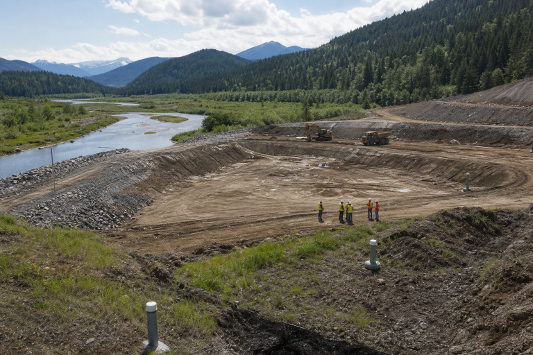
A reliable site picture usually begins with existing maps, well records, climate information, historical reports, aerial imagery, and land-use records. Field work can then test those assumptions through boreholes, test pits, monitoring wells, site inspections, and water sampling.
Repeated water-level measurements are often more useful than one-time readings because they reveal trends and responses to rainfall or pumping. Pumping tests can help estimate how readily water travels toward a well, while water-quality testing can identify concerns such as acidity, salinity, metals, nutrients, or suspended solids.
Digital sensors and geographic information systems can improve consistency, but they should support rather than replace field judgment.
How Data Supports Project Planning
Early Site Screening
Before major design costs begin, groundwater information can help compare locations and flag areas with flood susceptibility, seepage, settlement potential, water-supply limitations, or nearby sensitive receptors.
Design and Permitting
Findings can inform drainage systems, cutoff walls, liners, waterproofing, pumping plans, and treatment requirements. They also support clearer discussions with regulators, owners, contractors, and communities by distinguishing measured conditions from assumptions.
Construction and Operations
During work, monitoring can identify whether pumping or excavation is changing nearby groundwater levels. Trigger levels allow teams to adjust pumping rates, inspect controls, or review designs before impacts become more difficult to manage.
Groundwater and Climate Risk
Historical records remain valuable, but they may not fully represent future rainfall intensity, drought duration, wildfire effects, snowmelt timing, or recharge patterns.
Projects should consider both excess water and water shortage, since drought can reduce recharge while heavy rain can increase runoff, infiltration, and flooding. Climate-informed planning works best when broad projections are tested against local conditions.
The need for climate resilience in infrastructure decisions reinforces the value of place-based data, ongoing review, and adaptation measures that can be adjusted as conditions change.
Building a Groundwater Monitoring Plan
- Set the questions. Define the decisions the program must support.
- Select useful locations. Monitor relevant groundwater layers across and beyond the work area.
- Choose an appropriate schedule. Match frequency to risk, season, and construction activity.
- Record related conditions. Track rainfall, pumping, river levels, and major site events.
- Check quality. Review equipment, timestamps, unusual readings, and sampling procedures.
- Define action levels. State who responds and what happens when thresholds are exceeded.
- Update the site model. Revise assumptions when field evidence shows a different pattern.
Common Data Gaps and Mistakes
Weak decisions often start with an incomplete context. Common problems include collecting data in only one season, installing wells in the wrong layer, overlooking nearby pumping or drainage, relying on outdated records, and measuring water levels without considering chemistry.
Another frequent mistake is creating a model that is too complicated for project teams to apply. A useful model should clearly explain what is known, what remains uncertain, and what observation would require a different decision.
Turning Data into Better Decisions
Every measurement should connect to an action. If seasonal levels exceed design assumptions, review drainage, waterproofing, and construction timing.
If nearby wells respond to site pumping, adjust pumping rates and expand monitoring. If water chemistry changes near active work, investigate the source and assess containment or treatment needs.
When field readings differ from model results, the answer is not automatically to dismiss either one. Teams should test the original assumptions, assess data quality, and revise the working groundwater model where evidence warrants it.
Questions to Ask Before a Project Begins
- Which groundwater decisions must be made in the next six to twelve months?
- What information is measured, and what is assumed?
- Do available records represent wet, dry, and average conditions?
- Could work affect nearby wells, streams, wetlands, or structures?
- What conditions would trigger a design or operations review?
- Who will collect, interpret, store, and communicate the data?
Current Research and Policy Trends to Watch
Shared datasets, real-time sensors, climate scenarios, and data dashboards are making groundwater information easier to combine and review. These tools are most effective when they are grounded in sound fieldwork and paired with clear accountability for decisions.
Groundwater planning also increasingly considers connected surface water and ecological needs.
Work on protecting streamflow for salmon in a hotter, drier future illustrates how water supply, river flows, habitat, and long-term land-use choices can intersect.
Conclusion
Groundwater data helps teams replace guesswork with evidence when making decisions about a site, project, or environmental condition. The strongest approach is not to collect as much information as possible, but to identify which measurements are actually needed, gather them consistently, and interpret them in the context of the site’s geology, hydrology, and intended use.
Understanding the limits and uncertainty of each result is equally important, particularly when conditions can change with seasons, rainfall, pumping, construction, or nearby land use. When data is organized and reviewed over time, it can reveal trends that a single measurement may miss.
Connecting each result to a clear action also makes the information more useful throughout planning, construction, daily operations, regulatory review, and long-term environmental care.


